
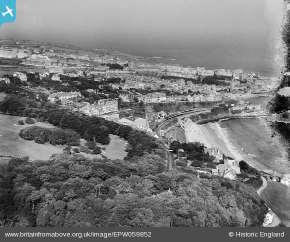
EPW059852 ENGLAND (1938). Porthminster Beach and the town, St Ives, from the south-east, 1938
© Copyright OpenStreetMap contributors and licensed by the OpenStreetMap Foundation. 2026. Cartography is licensed as CC BY-SA.
Nearby Images (4)
EPW059852

EPW059857

EPW039832

EPW007152

Details
| Title | [EPW059852] Porthminster Beach and the town, St Ives, from the south-east, 1938 |
| Reference | EPW059852 |
| Date | 22-September-1938 |
| Link | |
| Place name | ST IVES |
| Parish | ST. IVES |
| District | |
| Country | ENGLAND |
| Easting / Northing | 152213, 39815 |
| Longitude / Latitude | -5.4730313069886, 50.205763062186 |
| National Grid Reference | SW522398 |
Pins

come2scilly |
Saturday 13th of September 2014 11:08:48 PM | |

totoro |
Saturday 15th of June 2013 12:05:16 PM | |
|
totoro |
Saturday 15th of June 2013 12:04:39 PM | |
|
totoro |
Saturday 15th of June 2013 12:03:15 PM | |
|
totoro |
Saturday 15th of June 2013 12:02:46 PM |