
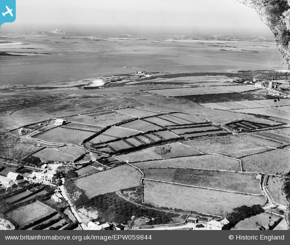
EPW059844 ENGLAND (1938). The aerodrome on Carn Morval Down and the islands beyond from the fields above Porthloo, St Mary's, from the south-east, 1938
© Copyright OpenStreetMap contributors and licensed by the OpenStreetMap Foundation. 2026. Cartography is licensed as CC BY-SA.
Nearby Images (2)
EPW059844

EPW059851

Details
| Title | [EPW059844] The aerodrome on Carn Morval Down and the islands beyond from the fields above Porthloo, St Mary's, from the south-east, 1938 |
| Reference | EPW059844 |
| Date | 22-September-1938 |
| Link | |
| Place name | ST MARY'S |
| Parish | ST. MARY'S |
| District | |
| Country | ENGLAND |
| Easting / Northing | 90985, 11631 |
| Longitude / Latitude | -6.3061514353113, 49.924193564291 |
| National Grid Reference | SV910116 |
Pins
Be the first to add a comment to this image!