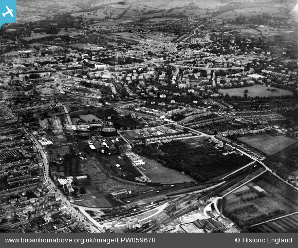
EPW059678 ENGLAND (1938). The town, Cheltenham, from the north-west, 1938
© Copyright OpenStreetMap contributors and licensed by the OpenStreetMap Foundation. 2026. Cartography is licensed as CC BY-SA.
Details
| Title | [EPW059678] The town, Cheltenham, from the north-west, 1938 |
| Reference | EPW059678 |
| Date | 29-September-1938 |
| Link | |
| Place name | CHELTENHAM |
| Parish | |
| District | |
| Country | ENGLAND |
| Easting / Northing | 393747, 223003 |
| Longitude / Latitude | -2.0909011494609, 51.905094694968 |
| National Grid Reference | SO937230 |
Pins

Nigel |
Tuesday 3rd of February 2026 10:21:26 AM | |

gBr |
Tuesday 24th of November 2015 03:19:11 PM | |

Class31 |
Saturday 26th of July 2014 11:22:50 PM | |

gerry-r |
Wednesday 16th of July 2014 11:28:25 PM | |

Toby Clempson |
Sunday 4th of May 2014 07:55:55 AM | |

Malc Mitch |
Friday 20th of September 2013 05:05:03 PM | |

Malc Mitch |
Friday 20th of September 2013 05:03:24 PM | |
The GWR retained the shed in use until c 1935 when the allocation was transferred to their Malvern Road depot, itself extended around this time. |

gBr |
Tuesday 24th of November 2015 03:29:05 PM |


![[EPW059678] The town, Cheltenham, from the north-west, 1938](http://britainfromabove.org.uk/sites/all/libraries/aerofilms-images/public/100x100/EPW/059/EPW059678.jpg)
![[EPR000383] The Central School and Cheltenham Gas Works off Gloucester Road, Alstone, 1934](http://britainfromabove.org.uk/sites/all/libraries/aerofilms-images/public/100x100/EPR/000/EPR000383.jpg)
![[EPW059677] Cheltenham Gas Works, Tewkesbury Road and environs, Cheltenham, 1938](http://britainfromabove.org.uk/sites/all/libraries/aerofilms-images/public/100x100/EPW/059/EPW059677.jpg)