
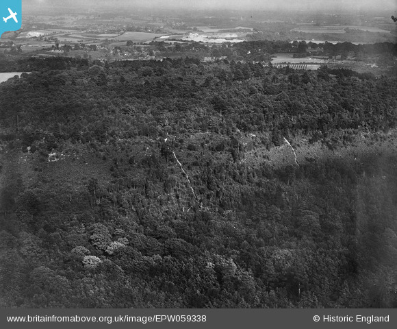
EPW059338 ENGLAND (1938). Oldbury Wood, Oldbury Hill, 1938
© Copyright OpenStreetMap contributors and licensed by the OpenStreetMap Foundation. 2026. Cartography is licensed as CC BY-SA.
Nearby Images (2)
EPW059338

EPW059337

Details
| Title | [EPW059338] Oldbury Wood, Oldbury Hill, 1938 |
| Reference | EPW059338 |
| Date | 12-September-1938 |
| Link | |
| Place name | OLDBURY HILL |
| Parish | IGHTHAM |
| District | |
| Country | ENGLAND |
| Easting / Northing | 558217, 156193 |
| Longitude / Latitude | 0.26892327899079, 51.282365191021 |
| National Grid Reference | TQ582562 |
Pins

Class31 |
Saturday 6th of July 2013 11:45:27 PM |
User Comment Contributions
View is looking east. |
Class31 |
Saturday 6th of July 2013 11:46:29 PM |