
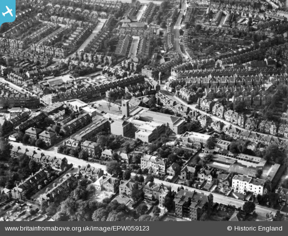
EPW059123 ENGLAND (1938). Hornsey Town Hall and environs, Crouch End, 1938. This image has been produced from a print.
© Copyright OpenStreetMap contributors and licensed by the OpenStreetMap Foundation. 2026. Cartography is licensed as CC BY-SA.
Nearby Images (2)
EPW059123

EPW059124

Details
| Title | [EPW059123] Hornsey Town Hall and environs, Crouch End, 1938. This image has been produced from a print. |
| Reference | EPW059123 |
| Date | 2-September-1938 |
| Link | |
| Place name | CROUCH END |
| Parish | |
| District | |
| Country | ENGLAND |
| Easting / Northing | 530178, 188346 |
| Longitude / Latitude | -0.1210967300842, 51.578449672414 |
| National Grid Reference | TQ302883 |
Pins

ChristopherD |
Thursday 7th of January 2016 11:58:30 PM | |
|
ChristopherD |
Thursday 7th of January 2016 11:57:55 PM | |
|
ChristopherD |
Thursday 7th of January 2016 11:56:55 PM | |
|
billyfern |
Sunday 2nd of November 2014 12:43:07 PM |