
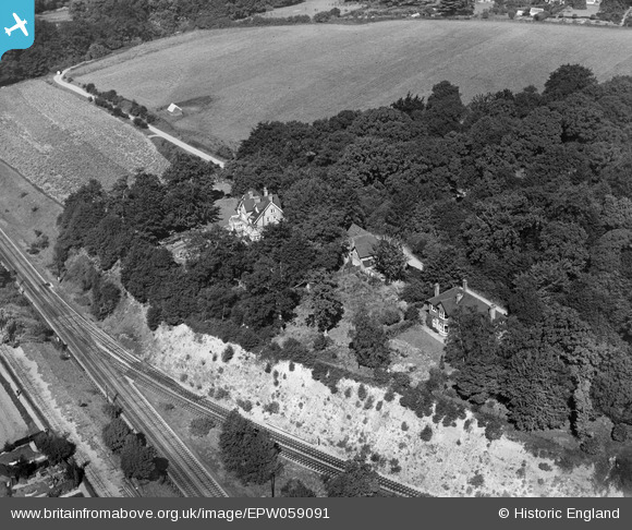
EPW059091 ENGLAND (1938). Croxley Wood House and Woodleys House, Croxley Green, 1938
© Copyright OpenStreetMap contributors and licensed by the OpenStreetMap Foundation. 2026. Cartography is licensed as CC BY-SA.
Nearby Images (2)
EPW059091

EPW059090

Details
| Title | [EPW059091] Croxley Wood House and Woodleys House, Croxley Green, 1938 |
| Reference | EPW059091 |
| Date | 2-September-1938 |
| Link | |
| Place name | CROXLEY GREEN |
| Parish | CROXLEY GREEN |
| District | |
| Country | ENGLAND |
| Easting / Northing | 506948, 194721 |
| Longitude / Latitude | -0.45429240300363, 51.640642650533 |
| National Grid Reference | TQ069947 |
Pins

John Wass |
Monday 8th of June 2015 03:24:47 PM | |
|
The Laird |
Saturday 18th of October 2014 08:58:31 PM | |
I think your guess about gravel movement is probably right. There were sidings at Croxley hall farm hence the double bridge which would have most likely been the destination of the narrow gauge track. Is it possible good could have also gone down to Salter Brewery ? |
Pete |
Wednesday 18th of May 2022 06:52:30 AM |
|
Bluid |
Wednesday 19th of March 2014 09:10:03 AM | |
|
Croxley history |
Wednesday 12th of June 2013 09:55:48 PM |