
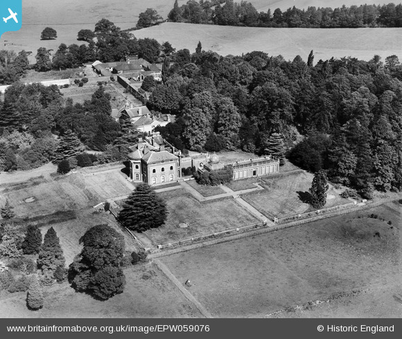
EPW059076 ENGLAND (1938). Pyrgo Park, Havering-atte-Bower, 1938
© Copyright OpenStreetMap contributors and licensed by the OpenStreetMap Foundation. 2026. Cartography is licensed as CC BY-SA.
Nearby Images (3)
EPW059076

EPW059077

EPW058748

Details
| Title | [EPW059076] Pyrgo Park, Havering-atte-Bower, 1938 |
| Reference | EPW059076 |
| Date | 2-September-1938 |
| Link | |
| Place name | HAVERING-ATTE-BOWER |
| Parish | |
| District | |
| Country | ENGLAND |
| Easting / Northing | 552184, 193672 |
| Longitude / Latitude | 0.1986009972555, 51.620795555763 |
| National Grid Reference | TQ522937 |
Pins

Hermann the German |
Wednesday 23rd of August 2017 06:20:06 PM |