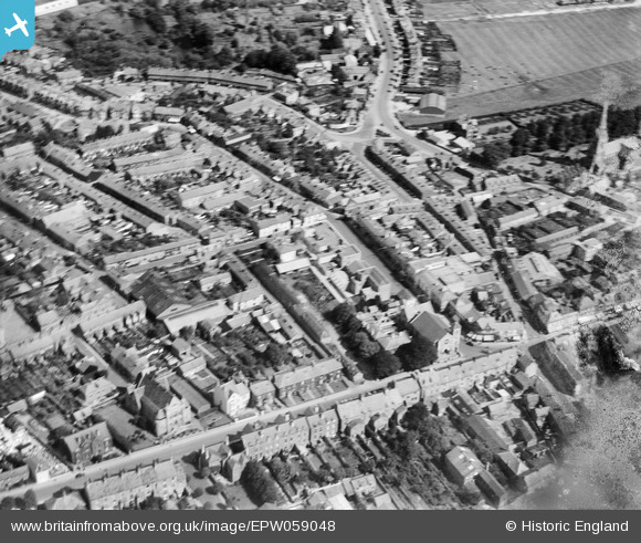
EPW059048 ENGLAND (1938). Old Town, Swindon, 1938
© Copyright OpenStreetMap contributors and licensed by the OpenStreetMap Foundation. 2026. Cartography is licensed as CC BY-SA.
Details
| Title | [EPW059048] Old Town, Swindon, 1938 |
| Reference | EPW059048 |
| Date | 30-August-1938 |
| Link | |
| Place name | SWINDON |
| Parish | |
| District | |
| Country | ENGLAND |
| Easting / Northing | 415513, 183864 |
| Longitude / Latitude | -1.7762296732686, 51.55297248005 |
| National Grid Reference | SU155839 |
Pins

NottmJas |
Saturday 16th of September 2023 10:16:27 PM | |

NottmJas |
Saturday 16th of September 2023 10:16:08 PM | |

NottmJas |
Monday 2nd of May 2022 10:09:03 PM | |

Delboy |
Wednesday 6th of May 2015 08:12:59 AM | |

Class31 |
Tuesday 14th of January 2014 10:15:56 AM | |

Class31 |
Tuesday 14th of January 2014 10:14:48 AM | |

Class31 |
Tuesday 14th of January 2014 10:13:50 AM | |

Class31 |
Tuesday 14th of January 2014 10:13:30 AM | |

Class31 |
Tuesday 14th of January 2014 10:08:05 AM |
User Comment Contributions
View looking north. |

Class31 |
Tuesday 14th of January 2014 10:08:23 AM |


![[EPW059048] Old Town, Swindon, 1938](http://britainfromabove.org.uk/sites/all/libraries/aerofilms-images/public/100x100/EPW/059/EPW059048.jpg)
![[EPW010119] General view of Swindon from Christ Church and the High Street area, Swindon, from the south-east, 1924](http://britainfromabove.org.uk/sites/all/libraries/aerofilms-images/public/100x100/EPW/010/EPW010119.jpg)
![[EPW010112] View of Swindon from Christ Church and the Belle Vue Avenue area, Swindon, from the south-east, 1924](http://britainfromabove.org.uk/sites/all/libraries/aerofilms-images/public/100x100/EPW/010/EPW010112.jpg)
![[EPW059050] Old Town, Swindon, 1938](http://britainfromabove.org.uk/sites/all/libraries/aerofilms-images/public/100x100/EPW/059/EPW059050.jpg)