
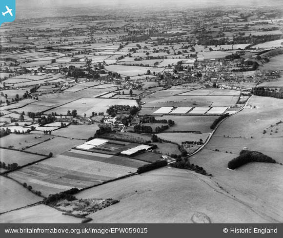
EPW059015 ENGLAND (1938). Nurseries off the A303, Burton and the town, Mere, from the north-east, 1938
© Copyright OpenStreetMap contributors and licensed by the OpenStreetMap Foundation. 2025. Cartography is licensed as CC BY-SA.
Nearby Images (2)
EPW059015

EPW058907

Details
| Title | [EPW059015] Nurseries off the A303, Burton and the town, Mere, from the north-east, 1938 |
| Reference | EPW059015 |
| Date | 31-August-1938 |
| Link | |
| Place name | MERE |
| Parish | MERE |
| District | |
| Country | ENGLAND |
| Easting / Northing | 382925, 132853 |
| Longitude / Latitude | -2.2438566155235, 51.094200933328 |
| National Grid Reference | ST829329 |
Pins

martynrb |
Saturday 15th of November 2025 02:02:03 PM | |
|
martynrb |
Saturday 15th of November 2025 02:00:00 PM | |
|
Jaz |
Wednesday 14th of August 2013 12:02:44 AM | |

Class31 |
Tuesday 13th of August 2013 11:56:17 AM | |
|
Class31 |
Tuesday 13th of August 2013 11:55:20 AM | |
|
Class31 |
Tuesday 13th of August 2013 11:45:17 AM | |
|
Class31 |
Tuesday 13th of August 2013 11:32:36 AM | |
|
Class31 |
Monday 12th of August 2013 01:41:03 PM |
User Comment Contributions
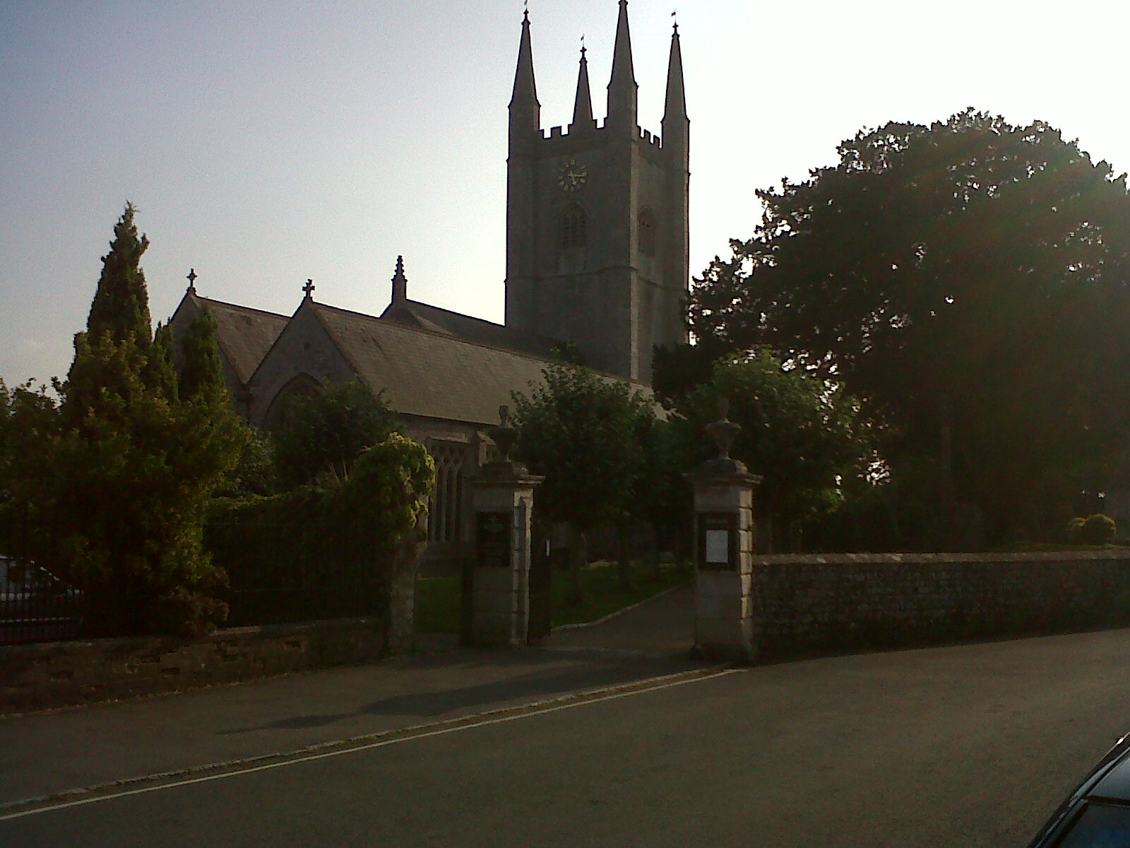
St. Michael's Parish Church, Mere 25/08/2013 |
Class31 |
Monday 26th of August 2013 09:40:37 PM |