
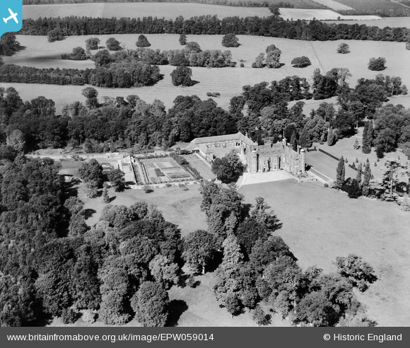
EPW059014 ENGLAND (1938). Madingley Hall, Madingley, 1938
© Copyright OpenStreetMap contributors and licensed by the OpenStreetMap Foundation. 2026. Cartography is licensed as CC BY-SA.
Nearby Images (7)
EPW059014

EPW059008

EPW059013

EPW059012

EPW059009

EPW059010

EPW059011

Details
| Title | [EPW059014] Madingley Hall, Madingley, 1938 |
| Reference | EPW059014 |
| Date | 2-September-1938 |
| Link | |
| Place name | MADINGLEY |
| Parish | MADINGLEY |
| District | |
| Country | ENGLAND |
| Easting / Northing | 539234, 260432 |
| Longitude / Latitude | 0.038651538612402, 52.224069997692 |
| National Grid Reference | TL392604 |
Pins
Be the first to add a comment to this image!