
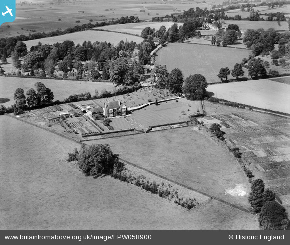
EPW058900 ENGLAND (1938). Ostlers house and the surrounding countryside, Curry Rivel, 1938
© Copyright OpenStreetMap contributors and licensed by the OpenStreetMap Foundation. 2025. Cartography is licensed as CC BY-SA.
Nearby Images (6)
EPW058900

EPW058904

EPW058902

EPW058905

EPW058903

EPW058901

Details
| Title | [EPW058900] Ostlers house and the surrounding countryside, Curry Rivel, 1938 |
| Reference | EPW058900 |
| Date | 26-August-1938 |
| Link | |
| Place name | CURRY RIVEL |
| Parish | CURRY RIVEL |
| District | |
| Country | ENGLAND |
| Easting / Northing | 338134, 125065 |
| Longitude / Latitude | -2.882155572686, 51.021086576298 |
| National Grid Reference | ST381251 |
Pins
Be the first to add a comment to this image!