
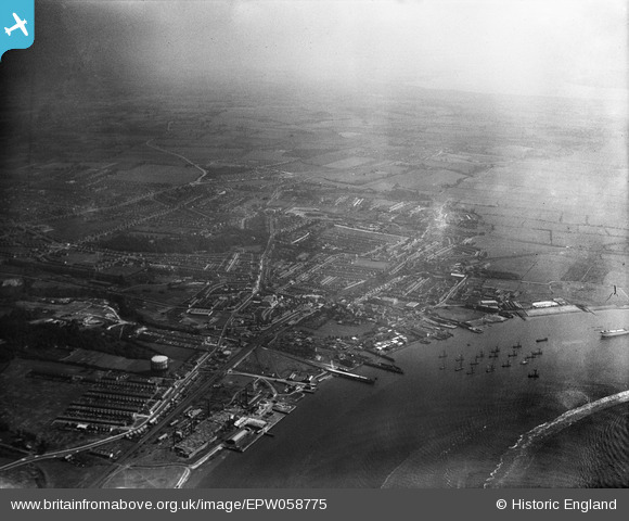
EPW058775 ENGLAND (1938). The town, the River Thames and environs, Grays, from the west, 1938. This image has been produced from a damaged negative.
© Copyright OpenStreetMap contributors and licensed by the OpenStreetMap Foundation. 2026. Cartography is licensed as CC BY-SA.
Nearby Images (8)
EPW058775

EPW006573

EPW006572

EPW006570

EPW006576

EPW006571

EPW006574

EPW006575

Details
| Title | [EPW058775] The town, the River Thames and environs, Grays, from the west, 1938. This image has been produced from a damaged negative. |
| Reference | EPW058775 |
| Date | 24-August-1938 |
| Link | |
| Place name | GRAYS |
| Parish | |
| District | |
| Country | ENGLAND |
| Easting / Northing | 560956, 177544 |
| Longitude / Latitude | 0.31784208143077, 51.473444214239 |
| National Grid Reference | TQ610775 |
Pins

Stephen Mirrington |
Tuesday 23rd of September 2025 05:24:00 PM | |
|
Mark |
Wednesday 20th of September 2023 09:36:50 PM | |

Dylan Moore |
Friday 26th of August 2016 04:41:54 PM | |
|
Dylan Moore |
Friday 26th of August 2016 04:41:23 PM | |
|
Dylan Moore |
Saturday 15th of June 2013 11:43:45 AM |