
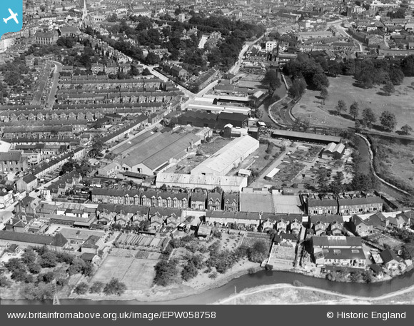
EPW058758 ENGLAND (1938). Cullingham Road, Handford Road Mills and environs, Ipswich, 1938
© Copyright OpenStreetMap contributors and licensed by the OpenStreetMap Foundation. 2026. Cartography is licensed as CC BY-SA.
Nearby Images (8)
EPW058758

EPW058756

EPW058755

EPW058757

EPW058754

EPW058753

EPW058752

EPW041403

Details
| Title | [EPW058758] Cullingham Road, Handford Road Mills and environs, Ipswich, 1938 |
| Reference | EPW058758 |
| Date | 23-August-1938 |
| Link | |
| Place name | IPSWICH |
| Parish | |
| District | |
| Country | ENGLAND |
| Easting / Northing | 615334, 244496 |
| Longitude / Latitude | 1.1413096439776, 52.05651303603 |
| National Grid Reference | TM153445 |
Pins
Be the first to add a comment to this image!