
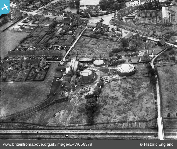
EPW058378 ENGLAND (1938). The town Gas Works, Uttoxeter, 1938
© Copyright OpenStreetMap contributors and licensed by the OpenStreetMap Foundation. 2026. Cartography is licensed as CC BY-SA.
Nearby Images (6)
EPW058378

EPW058375

EPW058374

EPW058377

EPW058373

EPW058376

Details
| Title | [EPW058378] The town Gas Works, Uttoxeter, 1938 |
| Reference | EPW058378 |
| Date | 28-July-1938 |
| Link | |
| Place name | UTTOXETER |
| Parish | UTTOXETER |
| District | |
| Country | ENGLAND |
| Easting / Northing | 409194, 334083 |
| Longitude / Latitude | -1.8632922867785, 52.903785114942 |
| National Grid Reference | SK092341 |
Pins

cidge |
Tuesday 17th of July 2018 10:49:30 PM | |
|
cidge |
Tuesday 17th of July 2018 10:42:17 PM | |
|
cidge |
Tuesday 17th of July 2018 10:36:31 PM | |
|
cidge |
Tuesday 17th of July 2018 10:35:06 PM | |
|
cidge |
Tuesday 17th of July 2018 10:33:16 PM |