
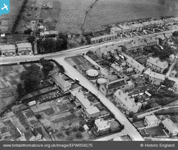
EPW058175 ENGLAND (1938). Kegworth Gas Works, Kegworth, 1938
© Copyright OpenStreetMap contributors and licensed by the OpenStreetMap Foundation. 2025. Cartography is licensed as CC BY-SA.
Nearby Images (6)
EPW058175

EPW058172

EPW058177

EPW058173

EPW058176

EPW058174

Details
| Title | [EPW058175] Kegworth Gas Works, Kegworth, 1938 |
| Reference | EPW058175 |
| Date | 20-July-1938 |
| Link | |
| Place name | KEGWORTH |
| Parish | KEGWORTH |
| District | |
| Country | ENGLAND |
| Easting / Northing | 448950, 327153 |
| Longitude / Latitude | -1.2732240532048, 52.839335782989 |
| National Grid Reference | SK490272 |
Pins
Be the first to add a comment to this image!