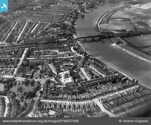
EPW057988 ENGLAND (1938). Barnes Bridge and the surrounding area alongside the River Thames, Mortlake, 1938. This image has been produced from a print.
© Copyright OpenStreetMap contributors and licensed by the OpenStreetMap Foundation. 2025. Cartography is licensed as CC BY-SA.
Details
| Title | [EPW057988] Barnes Bridge and the surrounding area alongside the River Thames, Mortlake, 1938. This image has been produced from a print. |
| Reference | EPW057988 |
| Date | 17-July-1938 |
| Link | |
| Place name | MORTLAKE |
| Parish | |
| District | |
| Country | ENGLAND |
| Easting / Northing | 521591, 176373 |
| Longitude / Latitude | -0.2491047739352, 51.472751496958 |
| National Grid Reference | TQ216764 |
Pins
Be the first to add a comment to this image!


![[EPW057988] Barnes Bridge and the surrounding area alongside the River Thames, Mortlake, 1938. This image has been produced from a print.](http://britainfromabove.org.uk/sites/all/libraries/aerofilms-images/public/100x100/EPW/057/EPW057988.jpg)
![[EPW025846] Chiswick, the Oxford and Cambridge Boat Race at Barnes Bridge, 1929](http://britainfromabove.org.uk/sites/all/libraries/aerofilms-images/public/100x100/EPW/025/EPW025846.jpg)