
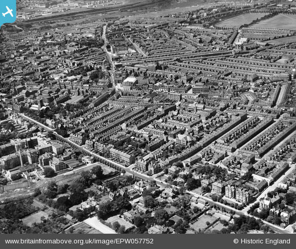
EPW057752 ENGLAND (1938). The residential area off Billing Road and the town centre, Northampton, 1938
© Copyright OpenStreetMap contributors and licensed by the OpenStreetMap Foundation. 2026. Cartography is licensed as CC BY-SA.
Nearby Images (4)
EPW057752

EPW054395

EPW054396

EPW054394

Details
| Title | [EPW057752] The residential area off Billing Road and the town centre, Northampton, 1938 |
| Reference | EPW057752 |
| Date | 21-June-1938 |
| Link | |
| Place name | NORTHAMPTON |
| Parish | |
| District | |
| Country | ENGLAND |
| Easting / Northing | 476130, 260688 |
| Longitude / Latitude | -0.88498564874557, 52.238713330286 |
| National Grid Reference | SP761607 |
Pins

Bruisbatty |
Thursday 31st of March 2022 04:58:45 PM | |
|
Bruisbatty |
Thursday 31st of March 2022 04:57:27 PM | |
|
Bruisbatty |
Thursday 31st of March 2022 04:56:33 PM | |
|
Ritchiet |
Wednesday 3rd of February 2016 10:02:11 PM | |
|
Ritchiet |
Wednesday 3rd of February 2016 10:00:58 PM |