
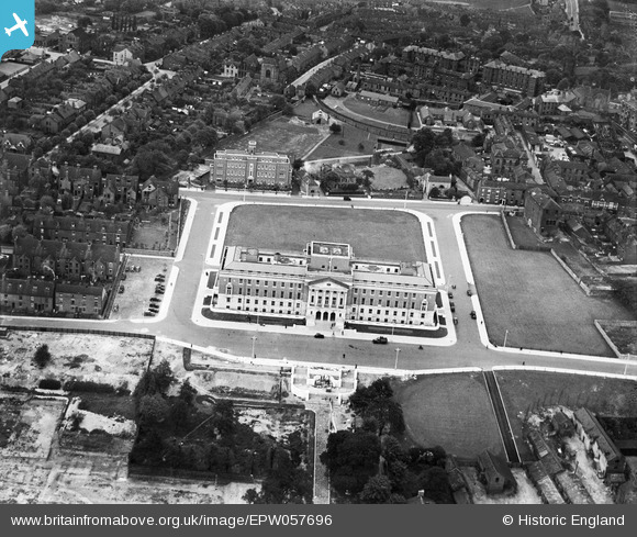
EPW057696 ENGLAND (1938). The Town Hall, Chesterfield, 1938
© Copyright OpenStreetMap contributors and licensed by the OpenStreetMap Foundation. 2026. Cartography is licensed as CC BY-SA.
Nearby Images (5)
EPW057696

EPW021078

EAW042512

EPW057697

EPW021079

Details
| Title | [EPW057696] The Town Hall, Chesterfield, 1938 |
| Reference | EPW057696 |
| Date | 20-June-1938 |
| Link | |
| Place name | CHESTERFIELD |
| Parish | |
| District | |
| Country | ENGLAND |
| Easting / Northing | 437981, 371228 |
| Longitude / Latitude | -1.4308805679065, 53.236442883123 |
| National Grid Reference | SK380712 |
Pins

Pete L |
Friday 6th of June 2014 10:14:55 PM |
User Comment Contributions
This Town Hall was built 1937-38. Architects were Bradshaw, Gass & Hope. (Information from the Derbyshire volume of Pevsner and Williamson 'Buildings of England') |
John W |
Tuesday 20th of December 2016 03:02:10 PM |