
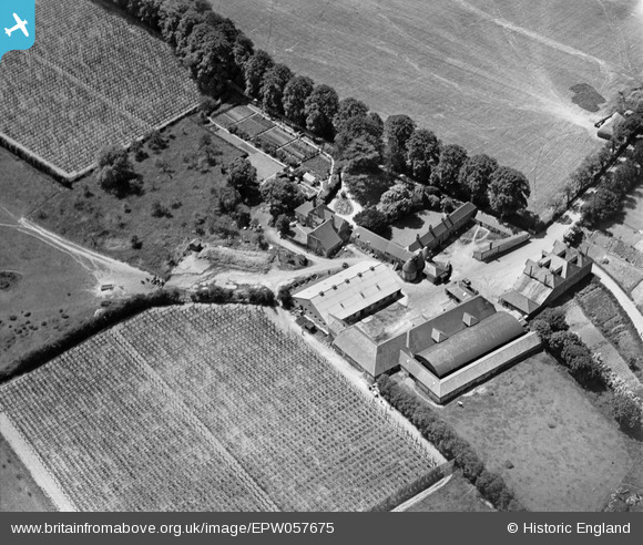
EPW057675 ENGLAND (1938). Bury Court Farm, Bentley, 1938
© Copyright OpenStreetMap contributors and licensed by the OpenStreetMap Foundation. 2026. Cartography is licensed as CC BY-SA.
Nearby Images (10)
EPW057675

EPW059059

EPW057677

EPW057676

EPW059057

EPW059051

EPW059058

EPW057678

EPW059056

EPW057673

Details
| Title | [EPW057675] Bury Court Farm, Bentley, 1938 |
| Reference | EPW057675 |
| Date | 21-June-1938 |
| Link | |
| Place name | BENTLEY |
| Parish | BENTLEY |
| District | |
| Country | ENGLAND |
| Easting / Northing | 478284, 145166 |
| Longitude / Latitude | -0.87941783271011, 51.199821021673 |
| National Grid Reference | SU783452 |
