
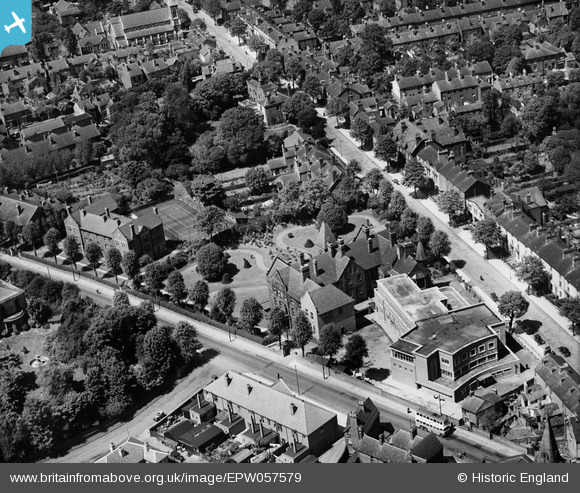
EPW057579 ENGLAND (1938). The Wolverhampton and Midland Eye Infirmary, Wolverhampton, 1938
© Copyright OpenStreetMap contributors and licensed by the OpenStreetMap Foundation. 2025. Cartography is licensed as CC BY-SA.
Nearby Images (6)
EPW057579

EPW057582

EPW057583

EPW057578

EPW057580

EPW057581

Details
| Title | [EPW057579] The Wolverhampton and Midland Eye Infirmary, Wolverhampton, 1938 |
| Reference | EPW057579 |
| Date | 14-June-1938 |
| Link | |
| Place name | WOLVERHAMPTON |
| Parish | |
| District | |
| Country | ENGLAND |
| Easting / Northing | 390382, 298631 |
| Longitude / Latitude | -2.141972585062, 52.58504373596 |
| National Grid Reference | SO904986 |
Pins

Elston |
Sunday 21st of February 2021 07:07:48 PM |