
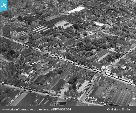
EPW057564 ENGLAND (1938). The High Street, New Street and environs, West Bromwich, 1938
© Copyright OpenStreetMap contributors and licensed by the OpenStreetMap Foundation. 2026. Cartography is licensed as CC BY-SA.
Nearby Images (15)
EPW057564

EPW021862

EPW042923

EPR000565

EPW042925

EPW057563

EPW042930

EPW042922

EPW042926

EPW042928

EPW042924

EPW042927

EPW042921

EPW042929

EPW021861

Details
| Title | [EPW057564] The High Street, New Street and environs, West Bromwich, 1938 |
| Reference | EPW057564 |
| Date | 14-June-1938 |
| Link | |
| Place name | WEST BROMWICH |
| Parish | |
| District | |
| Country | ENGLAND |
| Easting / Northing | 400533, 291199 |
| Longitude / Latitude | -1.9921442440712, 52.518308211953 |
| National Grid Reference | SP005912 |
Pins

Rob |
Friday 26th of August 2022 01:09:22 PM | |
|
DaveT |
Wednesday 27th of November 2013 06:57:21 PM | |
|
DaveT |
Sunday 20th of October 2013 01:56:36 PM | |
|
DaveT |
Sunday 20th of October 2013 01:42:52 PM |