
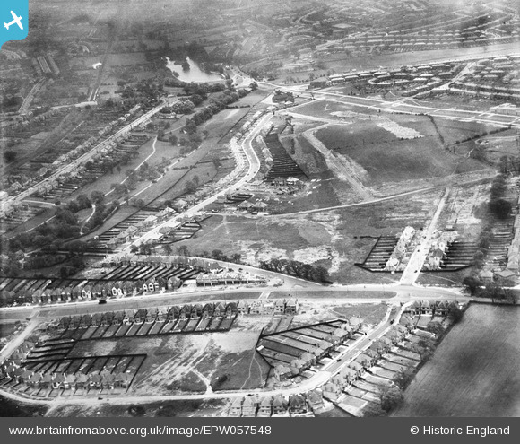
EPW057548 ENGLAND (1938). The residential area surrounding Colebourne Road, Glen Rise and The Hurst under construction, Billesley, 1938
© Copyright OpenStreetMap contributors and licensed by the OpenStreetMap Foundation. 2026. Cartography is licensed as CC BY-SA.
Nearby Images (8)
EPW057548

EPW057543

EPW057547

EPW057542

EPW057541

EPW057546

EPW057544

EPW057545

Details
| Title | [EPW057548] The residential area surrounding Colebourne Road, Glen Rise and The Hurst under construction, Billesley, 1938 |
| Reference | EPW057548 |
| Date | 11-June-1938 |
| Link | |
| Place name | BILLESLEY |
| Parish | |
| District | |
| Country | ENGLAND |
| Easting / Northing | 409514, 281015 |
| Longitude / Latitude | -1.8600664468349, 52.42666114353 |
| National Grid Reference | SP095810 |
Pins
Be the first to add a comment to this image!