
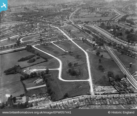
EPW057441 ENGLAND (1938). New roads for planned housing development at Brean Avenue and environs, Solihull, 1938
© Copyright OpenStreetMap contributors and licensed by the OpenStreetMap Foundation. 2026. Cartography is licensed as CC BY-SA.
Nearby Images (6)
EPW057441

EPW057444

EPW057445

EPW057443

EPW057440

EPW057442

Details
| Title | [EPW057441] New roads for planned housing development at Brean Avenue and environs, Solihull, 1938 |
| Reference | EPW057441 |
| Date | 7-June-1938 |
| Link | |
| Place name | SOLIHULL |
| Parish | |
| District | |
| Country | ENGLAND |
| Easting / Northing | 413734, 284296 |
| Longitude / Latitude | -1.7978633517892, 52.456070915824 |
| National Grid Reference | SP137843 |
Pins
Be the first to add a comment to this image!