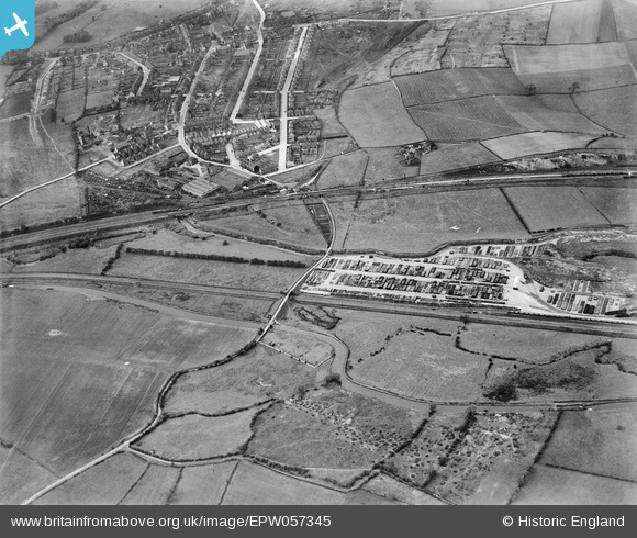
EPW057345 ENGLAND (1938). Railway sidings to the west of the Staveley Coal and Iron Company Ltd Works, Whittington Railway Station and environs, New Whittington, 1938
© Copyright OpenStreetMap contributors and licensed by the OpenStreetMap Foundation. 2024. Cartography is licensed as CC BY-SA.
Details
| Title | [EPW057345] Railway sidings to the west of the Staveley Coal and Iron Company Ltd Works, Whittington Railway Station and environs, New Whittington, 1938 |
| Reference | EPW057345 |
| Date | 3-June-1938 |
| Link | |
| Place name | NEW WHITTINGTON |
| Parish | |
| District | |
| Country | ENGLAND |
| Easting / Northing | 440226, 374853 |
| Longitude / Latitude | -1.3967845392172, 53.26886388719 |
| National Grid Reference | SK402749 |
Pins
 Maitland |
Saturday 26th of December 2015 10:02:23 AM | |
 Maitland |
Saturday 26th of December 2015 09:50:21 AM | |
 Maitland |
Saturday 26th of December 2015 09:47:38 AM | |
 Maitland |
Saturday 26th of December 2015 09:47:13 AM |


![[EPW057345] Railway sidings to the west of the Staveley Coal and Iron Company Ltd Works, Whittington Railway Station and environs, New Whittington, 1938](http://britainfromabove.org.uk/sites/all/libraries/aerofilms-images/public/100x100/EPW/057/EPW057345.jpg)
![[EPW057334] Railway sidings to the west of the Staveley Coal and Iron Company Ltd Works, Whittington Railway Station and environs, New Whittington, 1938](http://britainfromabove.org.uk/sites/all/libraries/aerofilms-images/public/100x100/EPW/057/EPW057334.jpg)
![[EPW057355] New Whittington Railway Station, the River Rother and environs, New Whittington, 1938](http://britainfromabove.org.uk/sites/all/libraries/aerofilms-images/public/100x100/EPW/057/EPW057355.jpg)
![[EPW057350] Railway sidings to the west of the Staveley Coal and Iron Company Ltd Works, Whittington Railway Station and environs, New Whittington, 1938](http://britainfromabove.org.uk/sites/all/libraries/aerofilms-images/public/100x100/EPW/057/EPW057350.jpg)