
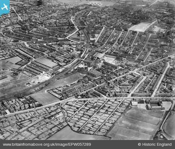
EPW057289 ENGLAND (1938). Shawlands and Slackhills, Barnsley, from the south-west, 1938
© Copyright OpenStreetMap contributors and licensed by the OpenStreetMap Foundation. 2026. Cartography is licensed as CC BY-SA.
Nearby Images (2)
EPW057289

EPW021095

Details
| Title | [EPW057289] Shawlands and Slackhills, Barnsley, from the south-west, 1938 |
| Reference | EPW057289 |
| Date | 25-May-1938 |
| Link | |
| Place name | BARNSLEY |
| Parish | |
| District | |
| Country | ENGLAND |
| Easting / Northing | 433442, 406231 |
| Longitude / Latitude | -1.4951816997277, 53.551399768916 |
| National Grid Reference | SE334062 |
