
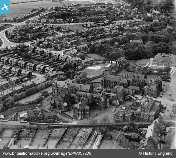
EPW057236 ENGLAND (1938). The Royal Albert Edward Infirmary, Wigan, 1938
© Copyright OpenStreetMap contributors and licensed by the OpenStreetMap Foundation. 2025. Cartography is licensed as CC BY-SA.
Nearby Images (8)
EPW057236

EPW057237

EPW057243

EPW057241

EPW057238

EPW057239

EPW057240

EPW057242

Details
| Title | [EPW057236] The Royal Albert Edward Infirmary, Wigan, 1938 |
| Reference | EPW057236 |
| Date | 25-May-1938 |
| Link | |
| Place name | WIGAN |
| Parish | |
| District | |
| Country | ENGLAND |
| Easting / Northing | 358327, 407028 |
| Longitude / Latitude | -2.6291668847849, 53.557974954234 |
| National Grid Reference | SD583070 |
Pins
 Eduardo |
Tuesday 16th of July 2019 04:17:27 PM |