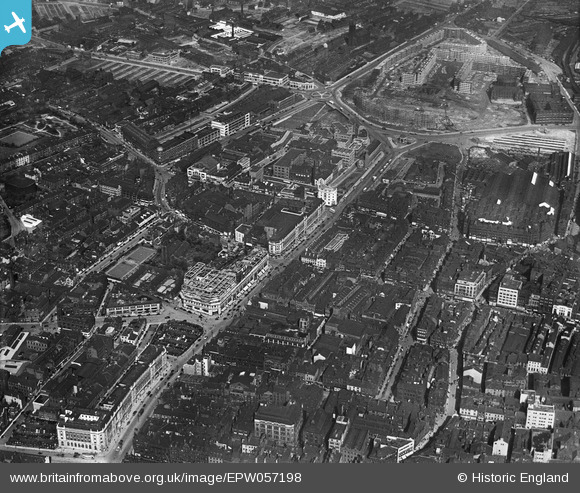
EPW057198 ENGLAND (1938). The Headrow, Eastgate and the Quarry Hill Flats under construction, Leeds, 1938
    © Copyright OpenStreetMap contributors and licensed by the OpenStreetMap Foundation. 2025. Cartography is licensed as CC BY-SA.
  
Details
| Title | [EPW057198] The Headrow, Eastgate and the Quarry Hill Flats under construction, Leeds, 1938 | 
| Reference | EPW057198 | 
| Date | 24-May-1938 | 
| Link | |
| Place name | LEEDS | 
| Parish | |
| District | |
| Country | ENGLAND | 
| Easting / Northing | 430304, 433752 | 
| Longitude / Latitude | -1.5398611383339, 53.798974080468 | 
| National Grid Reference | SE303338 | 
Pins
|  In simpler times that was a petrol station.   Time passes, traffic became heavier  and killed the business. |   Ray | Saturday 1st of April 2023 11:07:24 AM | 
 
             
  ![[EPW057198] The Headrow, Eastgate and the Quarry Hill Flats under construction, Leeds, 1938](http://britainfromabove.org.uk/sites/all/libraries/aerofilms-images/public/100x100/EPW/057/EPW057198.jpg) 
  
                                          ![[EAW014657] Briggate, The Headrow and environs, Leeds, 1948](http://britainfromabove.org.uk/sites/all/libraries/aerofilms-images/public/100x100/EAW/014/EAW014657.jpg) 
 ![[EPW015897] Kirkgate Market and environs, Leeds, 1926. This image has been produced from a copy-negative.](http://britainfromabove.org.uk/sites/all/libraries/aerofilms-images/public/100x100/EPW/015/EPW015897.jpg) 
 ![[EPW057202] Kirkgate and environs, Leeds, 1938. This image has been produced from a copy-negative.](http://britainfromabove.org.uk/sites/all/libraries/aerofilms-images/public/100x100/EPW/057/EPW057202.jpg)