
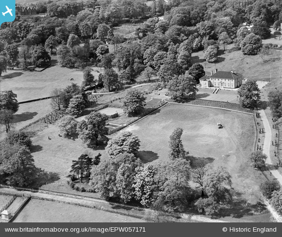
EPW057171 ENGLAND (1938). Brenaire Park House and Garden, Rawdon, 1938
© Copyright OpenStreetMap contributors and licensed by the OpenStreetMap Foundation. 2026. Cartography is licensed as CC BY-SA.
Nearby Images (6)
EPW057171

EPW057172

EPW057170

EPW057167

EPW057169

EPW057168

Details
| Title | [EPW057171] Brenaire Park House and Garden, Rawdon, 1938 |
| Reference | EPW057171 |
| Date | 24-May-1938 |
| Link | |
| Place name | RAWDON |
| Parish | |
| District | |
| Country | ENGLAND |
| Easting / Northing | 420318, 438723 |
| Longitude / Latitude | -1.6911580972666, 53.844143513769 |
| National Grid Reference | SE203387 |
Pins
Be the first to add a comment to this image!