
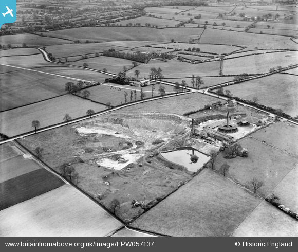
EPW057137 ENGLAND (1938). Ibstock Brick Ltd Brick Works, Dorket Head, 1938
© Copyright OpenStreetMap contributors and licensed by the OpenStreetMap Foundation. 2025. Cartography is licensed as CC BY-SA.
Nearby Images (6)
EPW057137

EPW057138

EPW057135

EPW057136

EPW057134

EPW057133

Details
| Title | [EPW057137] Ibstock Brick Ltd Brick Works, Dorket Head, 1938 |
| Reference | EPW057137 |
| Date | 20-May-1938 |
| Link | |
| Place name | DORKET HEAD |
| Parish | |
| District | |
| Country | ENGLAND |
| Easting / Northing | 459325, 347503 |
| Longitude / Latitude | -1.1154798423802, 53.021224350977 |
| National Grid Reference | SK593475 |
Pins

Geoff Jay |
Thursday 24th of July 2014 08:59:32 PM | |
|
Geoff Jay |
Thursday 24th of July 2014 08:56:50 PM | |
|
Geoff Jay |
Thursday 24th of July 2014 08:54:53 PM | |
|
pim-54 |
Friday 4th of July 2014 12:19:28 AM | |
Slight mistake here, this is not the road to Arnold, it is Lime Lane leading to the Ollerton Road. |
Geoff Jay |
Thursday 24th of July 2014 08:52:53 PM |
|
pim-54 |
Friday 4th of July 2014 12:18:48 AM | |
This is Woodborough Lane, not the road to Calverton. |
Geoff Jay |
Thursday 24th of July 2014 08:53:58 PM |