
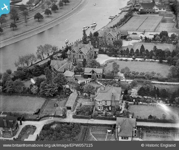
EPW057115 ENGLAND (1938). Private houses alongside the River Trent, West Bridgford, 1938. This image has been affected by flare.
© Copyright OpenStreetMap contributors and licensed by the OpenStreetMap Foundation. 2026. Cartography is licensed as CC BY-SA.
Nearby Images (3)
EPW057115

EPW057111

EPW057114

Details
| Title | [EPW057115] Private houses alongside the River Trent, West Bridgford, 1938. This image has been affected by flare. |
| Reference | EPW057115 |
| Date | 20-May-1938 |
| Link | |
| Place name | WEST BRIDGFORD |
| Parish | |
| District | |
| Country | ENGLAND |
| Easting / Northing | 457674, 337415 |
| Longitude / Latitude | -1.1418911506613, 52.930721369266 |
| National Grid Reference | SK577374 |
Pins

Dom Sweeney |
Monday 21st of October 2013 08:16:38 PM |