
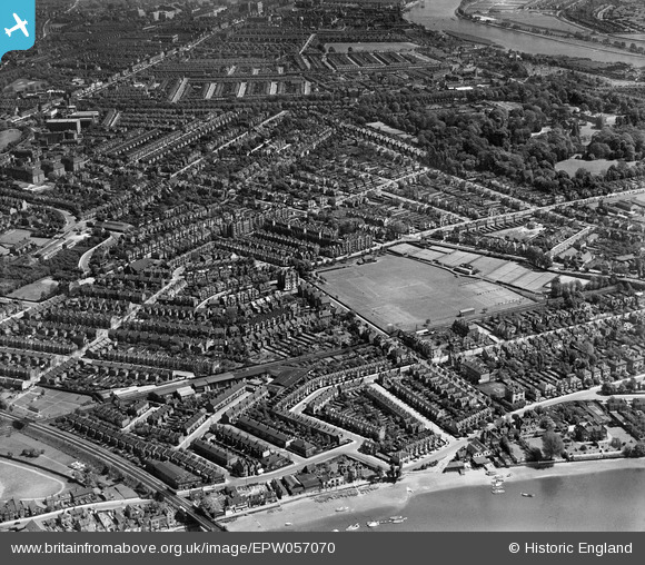
EPW057070 ENGLAND (1938). Grove Park, Chiswick, from the south-west, 1938
© Copyright OpenStreetMap contributors and licensed by the OpenStreetMap Foundation. 2026. Cartography is licensed as CC BY-SA.
Nearby Images (3)
EPW057070

EPW060786

EPW060787

Details
| Title | [EPW057070] Grove Park, Chiswick, from the south-west, 1938 |
| Reference | EPW057070 |
| Date | 12-May-1938 |
| Link | |
| Place name | CHISWICK |
| Parish | |
| District | |
| Country | ENGLAND |
| Easting / Northing | 519854, 177587 |
| Longitude / Latitude | -0.27369305365241, 51.484034182331 |
| National Grid Reference | TQ199776 |
Pins

Martin Devlin |
Wednesday 26th of January 2022 02:37:12 PM | |
|
60009 |
Friday 12th of November 2021 06:55:01 PM | |
|
Rudgey |
Friday 30th of September 2016 02:11:36 PM | |
 |

Class31 |
Tuesday 26th of May 2015 09:09:51 PM |
|
John Ray |
Friday 14th of June 2013 10:37:28 PM | |
|
John Ray |
Friday 14th of June 2013 10:36:26 PM | |
|
John Ray |
Friday 14th of June 2013 10:34:27 PM |