
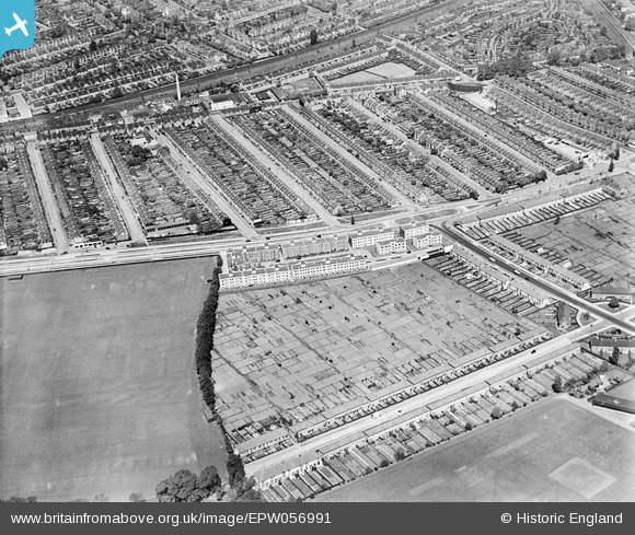
EPW056991 ENGLAND (1938). Merton Mansions in Raynes Park, Bushey Mead, 1938
© Copyright OpenStreetMap contributors and licensed by the OpenStreetMap Foundation. 2026. Cartography is licensed as CC BY-SA.
Nearby Images (4)
EPW056991

EPW056990

EPW056992

EPW056993

Details
| Title | [EPW056991] Merton Mansions in Raynes Park, Bushey Mead, 1938 |
| Reference | EPW056991 |
| Date | 5-May-1938 |
| Link | |
| Place name | BUSHEY MEAD |
| Parish | |
| District | |
| Country | ENGLAND |
| Easting / Northing | 523848, 169074 |
| Longitude / Latitude | -0.21917496726031, 51.40665665364 |
| National Grid Reference | TQ238691 |
Pins

gruntie |
Tuesday 26th of July 2016 05:07:52 PM | |
|
gruntie |
Thursday 27th of June 2013 10:02:18 AM | |

Maurice |
Thursday 27th of June 2013 08:20:14 AM | |
|
gruntie |
Thursday 27th of June 2013 06:44:53 AM | |
Yes. Most of it dating from when this photo was taken! |
wessexpig |
Monday 23rd of June 2014 09:50:26 PM |
|
MikeBellew |
Monday 17th of June 2013 01:33:23 PM | |
Originally a 'cattle arch' so that livestock could move between fields either side of the line. The step in the roof bears witness to the railway being built in 2 stages. |
gruntie |
Thursday 27th of June 2013 08:24:45 AM |
There is a fascinating piece of film on the Pathe archive, here: http://www.britishpathe.com/video/bells-peel-warning-wimbledon In the 60's the underpass at Raynes Park was closed for a while and this arch became a local diversion. Bells were strung across the road on both sides to give an "overheight" warning. |
gruntie |
Sunday 6th of October 2013 10:08:07 AM |