
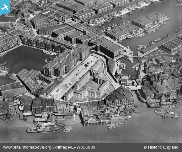
EPW056989 ENGLAND (1938). The Stephen and Matilda Estate beside St Katherine's Docks, St Katherine Docks, 1938
© Copyright OpenStreetMap contributors and licensed by the OpenStreetMap Foundation. 2026. Cartography is licensed as CC BY-SA.
Nearby Images (16)
EPW056989

EPW056986

EPW056988

EPW056985

EPW056987

EPW044141

EAW622105

EPW045556

EPW056984

EPW044140

EAW000632

EPW045382

EAW035309

EAW018320

EPW044137

EAW000635

Details
| Title | [EPW056989] The Stephen and Matilda Estate beside St Katherine's Docks, St Katherine Docks, 1938 |
| Reference | EPW056989 |
| Date | 5-May-1938 |
| Link | |
| Place name | ST KATHERINE DOCKS |
| Parish | |
| District | |
| Country | ENGLAND |
| Easting / Northing | 534145, 180307 |
| Longitude / Latitude | -0.0669389638567, 51.50527037921 |
| National Grid Reference | TQ341803 |
Pins

Alan McFaden |
Tuesday 26th of August 2014 12:47:52 PM |

User Comment Contributions
These docks are named after St Katherine, they don't belong to her. The modern roads all about seem to have apostrophes, but the docks do not. |

JJR |
Thursday 4th of July 2013 04:35:45 PM |