
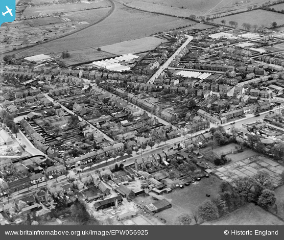
EPW056925 ENGLAND (1938). High Street South, Great Northern Road and environs, Dunstable, 1938
© Copyright OpenStreetMap contributors and licensed by the OpenStreetMap Foundation. 2026. Cartography is licensed as CC BY-SA.
Nearby Images (2)
EPW056925

EPW056926

Details
| Title | [EPW056925] High Street South, Great Northern Road and environs, Dunstable, 1938 |
| Reference | EPW056925 |
| Date | 26-April-1938 |
| Link | |
| Place name | DUNSTABLE |
| Parish | DUNSTABLE |
| District | |
| Country | ENGLAND |
| Easting / Northing | 502430, 221451 |
| Longitude / Latitude | -0.51168545416053, 51.881762088317 |
| National Grid Reference | TL024215 |
Pins

Bluid |
Tuesday 25th of February 2014 01:30:07 PM |