
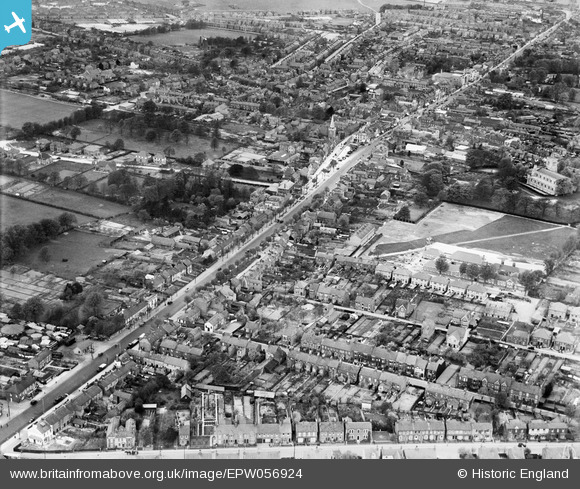
EPW056924 ENGLAND (1938). High Street South and the town centre, Dunstable, 1938
© Copyright OpenStreetMap contributors and licensed by the OpenStreetMap Foundation. 2026. Cartography is licensed as CC BY-SA.
Nearby Images (5)
EPW056924

EPW023863

EPW056926

EPW056927

EPW023860

Details
| Title | [EPW056924] High Street South and the town centre, Dunstable, 1938 |
| Reference | EPW056924 |
| Date | 26-April-1938 |
| Link | |
| Place name | DUNSTABLE |
| Parish | DUNSTABLE |
| District | |
| Country | ENGLAND |
| Easting / Northing | 502175, 221598 |
| Longitude / Latitude | -0.51534573840197, 51.883130252169 |
| National Grid Reference | TL022216 |
Pins

Bluid |
Monday 30th of September 2019 02:17:15 AM | |
|
Bluid |
Monday 30th of June 2014 11:58:52 PM | |
|
Bluid |
Monday 30th of June 2014 11:57:06 PM | |
|
Bluid |
Monday 30th of June 2014 11:55:54 PM | |
|
Jester |
Monday 23rd of September 2013 05:56:37 PM |

User Comment Contributions
In "Britain Street." Previously known as "Priory Middle School." Established in 1911. |
Jester |
Monday 23rd of September 2013 06:47:08 PM |