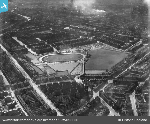
EPW056838 ENGLAND (1938). The Paddington Recreation Ground, Maida Vale, 1938
© Copyright OpenStreetMap contributors and licensed by the OpenStreetMap Foundation. 2024. Cartography is licensed as CC BY-SA.
Details
| Title | [EPW056838] The Paddington Recreation Ground, Maida Vale, 1938 |
| Reference | EPW056838 |
| Date | 11-April-1938 |
| Link | |
| Place name | MAIDA VALE |
| Parish | |
| District | |
| Country | ENGLAND |
| Easting / Northing | 525613, 182831 |
| Longitude / Latitude | -0.1889190204753, 51.529917295678 |
| National Grid Reference | TQ256828 |
Pins
 Loz207 |
Friday 8th of September 2023 05:36:52 PM | |
 Class31 |
Wednesday 8th of October 2014 04:14:31 PM | |
 Class31 |
Wednesday 10th of September 2014 04:11:17 PM | |
 Class31 |
Wednesday 10th of September 2014 04:10:39 PM | |
 Class31 |
Wednesday 10th of September 2014 04:10:10 PM | |
 Class31 |
Wednesday 10th of September 2014 04:08:52 PM | |
 Class31 |
Wednesday 10th of September 2014 04:08:20 PM | |
 Class31 |
Wednesday 10th of September 2014 04:07:53 PM |


![[EPW056838] The Paddington Recreation Ground, Maida Vale, 1938](http://britainfromabove.org.uk/sites/all/libraries/aerofilms-images/public/100x100/EPW/056/EPW056838.jpg)
![[EPW009098] The Paddington Recreation Ground and environs, Maida Vale, 1923](http://britainfromabove.org.uk/sites/all/libraries/aerofilms-images/public/100x100/EPW/009/EPW009098.jpg)