
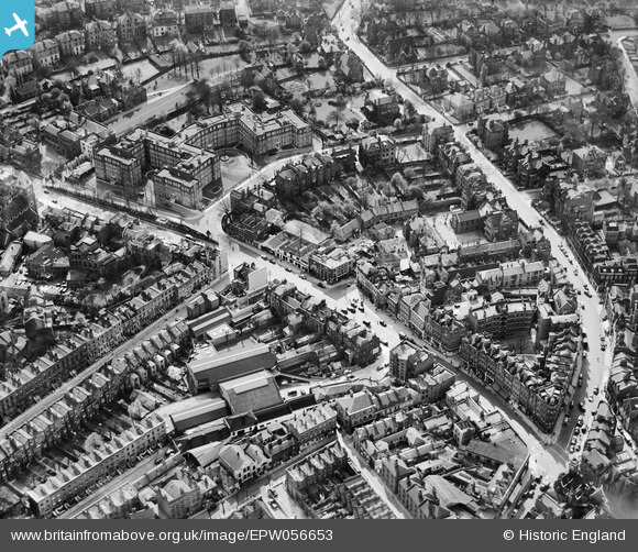
EPW056653 ENGLAND (1938). The High Street and environs, Hampstead, 1938
© Copyright OpenStreetMap contributors and licensed by the OpenStreetMap Foundation. 2026. Cartography is licensed as CC BY-SA.
Nearby Images (11)
EPW056653

EPW056658

EPW056654

EPW056651

EPW056665

EPW057007

EPW057006

EPW056830

EPW056833

EPW000812

EAW000617

Details
| Title | [EPW056653] The High Street and environs, Hampstead, 1938 |
| Reference | EPW056653 |
| Date | 30-March-1938 |
| Link | |
| Place name | HAMPSTEAD |
| Parish | |
| District | |
| Country | ENGLAND |
| Easting / Northing | 526489, 185661 |
| Longitude / Latitude | -0.1752784082156, 51.555157399654 |
| National Grid Reference | TQ265857 |
Pins

Mark Amies |
Tuesday 11th of June 2024 05:38:35 AM | |

Class31 |
Monday 27th of October 2014 02:26:40 PM | |
|
Class31 |
Monday 27th of October 2014 02:23:38 PM | |
|
Class31 |
Monday 27th of October 2014 02:22:38 PM | |
|
Class31 |
Monday 27th of October 2014 02:21:47 PM | |
|
Class31 |
Monday 27th of October 2014 02:21:09 PM | |
|
Class31 |
Monday 27th of October 2014 02:20:18 PM | |
|
RHB27 |
Friday 10th of January 2014 11:11:22 PM |


