
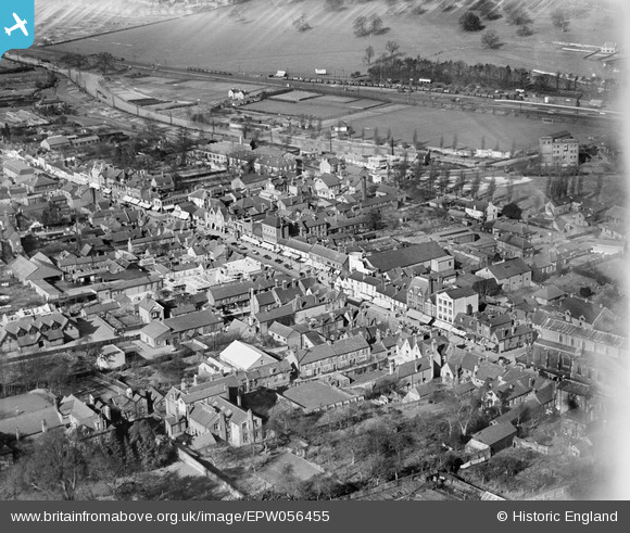
EPW056455 ENGLAND (1938). The High Street, Berkhamsted, 1938
© Copyright OpenStreetMap contributors and licensed by the OpenStreetMap Foundation. 2026. Cartography is licensed as CC BY-SA.
Nearby Images (10)
EPW056455

EPW022501

EPW005239

EPW056456

EPW005037

EPW005032

EPW005035

EPW021329

EPW056459

EAW041753

Details
| Title | [EPW056455] The High Street, Berkhamsted, 1938 |
| Reference | EPW056455 |
| Date | 4-March-1938 |
| Link | |
| Place name | BERKHAMSTED |
| Parish | BERKHAMSTED |
| District | |
| Country | ENGLAND |
| Easting / Northing | 499213, 207826 |
| Longitude / Latitude | -0.56231690914106, 51.759866423201 |
| National Grid Reference | SP992078 |
