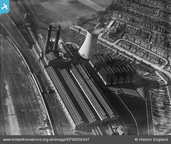
EPW056447 ENGLAND (1938). The power station and London, Midland and Scottish Railway depot, Stonebridge, 1938
© Copyright OpenStreetMap contributors and licensed by the OpenStreetMap Foundation. 2026. Cartography is licensed as CC BY-SA.
Details
| Title | [EPW056447] The power station and London, Midland and Scottish Railway depot, Stonebridge, 1938 |
| Reference | EPW056447 |
| Date | 4-March-1938 |
| Link | |
| Place name | STONEBRIDGE |
| Parish | |
| District | |
| Country | ENGLAND |
| Easting / Northing | 519070, 184580 |
| Longitude / Latitude | -0.28261703414034, 51.547056016024 |
| National Grid Reference | TQ191846 |
Pins

Ginger79 |
Saturday 28th of March 2020 12:12:14 AM |


![[EPW056447] The power station and London, Midland and Scottish Railway depot, Stonebridge, 1938](http://britainfromabove.org.uk/sites/all/libraries/aerofilms-images/public/100x100/EPW/056/EPW056447.jpg)
![[EPW041904] The power station and London, Midland and Scottish Railway depot, Stonebridge, 1933](http://britainfromabove.org.uk/sites/all/libraries/aerofilms-images/public/100x100/EPW/041/EPW041904.jpg)
![[EPW006172] London and North Western Railway Depot, Wembley, 1921](http://britainfromabove.org.uk/sites/all/libraries/aerofilms-images/public/100x100/EPW/006/EPW006172.jpg)
![[EAW041244] Fog over Wembley Stadium and the residential area around St Michael's Avenue, Tokyngton, 1951](http://britainfromabove.org.uk/sites/all/libraries/aerofilms-images/public/100x100/EAW/041/EAW041244.jpg)