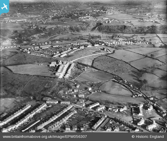
EPW056307 ENGLAND (1938). Broom Hill, Brislington, from the south-west, 1938
© Copyright OpenStreetMap contributors and licensed by the OpenStreetMap Foundation. 2024. Cartography is licensed as CC BY-SA.
Nearby Images (6)
Details
| Title | [EPW056307] Broom Hill, Brislington, from the south-west, 1938 |
| Reference | EPW056307 |
| Date | 24-January-1938 |
| Link | |
| Place name | BRISLINGTON |
| Parish | |
| District | |
| Country | ENGLAND |
| Easting / Northing | 362235, 171269 |
| Longitude / Latitude | -2.5433893554972, 51.438665880302 |
| National Grid Reference | ST622713 |
Pins
 tony way |
Saturday 26th of December 2015 08:53:39 PM | |
 MB |
Saturday 6th of July 2013 10:10:31 PM | |
 MB |
Saturday 6th of July 2013 10:08:42 PM | |
 MB |
Saturday 6th of July 2013 10:08:20 PM | |
 MB |
Saturday 6th of July 2013 10:07:43 PM | |
 MB |
Saturday 6th of July 2013 10:05:39 PM |


![[EPW056307] Broom Hill, Brislington, from the south-west, 1938](http://britainfromabove.org.uk/sites/all/libraries/aerofilms-images/public/100x100/EPW/056/EPW056307.jpg)
![[EPW056305] Broom Hill, Brislington, from the south-west, 1938](http://britainfromabove.org.uk/sites/all/libraries/aerofilms-images/public/100x100/EPW/056/EPW056305.jpg)
![[EPW056312] Broom Hill, Brislington, from the south-west, 1938](http://britainfromabove.org.uk/sites/all/libraries/aerofilms-images/public/100x100/EPW/056/EPW056312.jpg)
![[EPW056303] Allison Road and environs, Broom Hill, 1938](http://britainfromabove.org.uk/sites/all/libraries/aerofilms-images/public/100x100/EPW/056/EPW056303.jpg)
![[EPW056309] Broom Hill, Brislington, from the south-west, 1938](http://britainfromabove.org.uk/sites/all/libraries/aerofilms-images/public/100x100/EPW/056/EPW056309.jpg)
![[EPW056310] Broom Hill, Brislington, from the south-west, 1938](http://britainfromabove.org.uk/sites/all/libraries/aerofilms-images/public/100x100/EPW/056/EPW056310.jpg)