
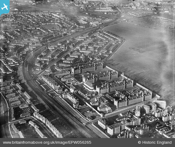
EPW056265 ENGLAND (1938). HM Prison Wormwood Scrubs and environs, Wormwood Scrubs, 1938
© Copyright OpenStreetMap contributors and licensed by the OpenStreetMap Foundation. 2026. Cartography is licensed as CC BY-SA.
Nearby Images (5)
EPW056265

EAW009113

EPW034915

EPW034914

EPW034916

Details
| Title | [EPW056265] HM Prison Wormwood Scrubs and environs, Wormwood Scrubs, 1938 |
| Reference | EPW056265 |
| Date | 17-January-1938 |
| Link | |
| Place name | WORMWOOD SCRUBS |
| Parish | |
| District | |
| Country | ENGLAND |
| Easting / Northing | 522063, 181262 |
| Longitude / Latitude | -0.24062007582067, 51.516593525614 |
| National Grid Reference | TQ221813 |
Pins

KarenH |
Monday 11th of May 2020 08:52:21 AM | |
|
kiewa |
Thursday 27th of November 2014 10:21:38 AM | |
|
Bellhop |
Tuesday 3rd of September 2013 10:46:52 AM | |
I would respectfully suggest that "Bellhop" re-refers to his A-Z; mine reads that Braybrook St.is in East Acton. Otherwise an interesting point. |
Wilmington |
Sunday 18th of May 2014 07:36:17 AM |