
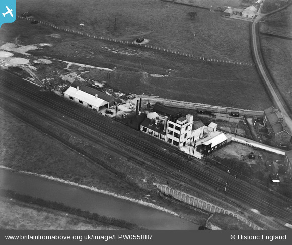
EPW055887 ENGLAND (1937). The Garstang Creamery on Kenlis Road, Bowgreave, 1937
© Copyright OpenStreetMap contributors and licensed by the OpenStreetMap Foundation. 2026. Cartography is licensed as CC BY-SA.
Nearby Images (6)
EPW055887

EPW055885

EPW055883

EPW055884

EPW055888

EPW055886

Details
| Title | [EPW055887] The Garstang Creamery on Kenlis Road, Bowgreave, 1937 |
| Reference | EPW055887 |
| Date | 24-October-1937 |
| Link | |
| Place name | BOWGREAVE |
| Parish | BARNACRE-WITH-BONDS |
| District | |
| Country | ENGLAND |
| Easting / Northing | 350943, 444064 |
| Longitude / Latitude | -2.7465118620403, 53.890229826767 |
| National Grid Reference | SD509441 |
Pins
Be the first to add a comment to this image!