
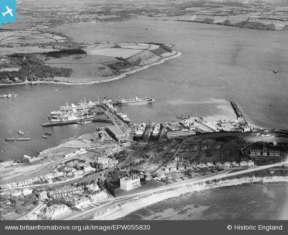
EPW055830 ENGLAND (1937). Falmouth Docks and Trefusis Point, Falmouth, 1937
© Copyright OpenStreetMap contributors and licensed by the OpenStreetMap Foundation. 2026. Cartography is licensed as CC BY-SA.
Nearby Images (18)
EPW055830

EPW055831

EPW045675

EPW045679

EPW045672

EPW045673

EPW045681

EPW023356

EAW033626

EPW045677

EPW023371

EPW055833

EPW055834

EAW033625

EPW021712

EPW021714

EPW021716

EPW021713

Details
| Title | [EPW055830] Falmouth Docks and Trefusis Point, Falmouth, 1937 |
| Reference | EPW055830 |
| Date | 15-October-1937 |
| Link | |
| Place name | FALMOUTH |
| Parish | FALMOUTH |
| District | |
| Country | ENGLAND |
| Easting / Northing | 181941, 32902 |
| Longitude / Latitude | -5.0530652144275, 50.155374570791 |
| National Grid Reference | SW819329 |
Pins
Be the first to add a comment to this image!