
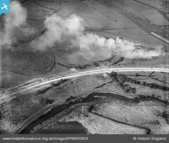
EPW055810 ENGLAND (1937). Construction of Raynesway (Town Planning Road No 4) on the stretch between the River Derwent crossing and the Derby Corporation Sewage Works, Spondon, 1937
© Copyright OpenStreetMap contributors and licensed by the OpenStreetMap Foundation. 2026. Cartography is licensed as CC BY-SA.
Nearby Images (3)
EPW055810
 on the stretch between the River Derwent crossing and the Derby Corporation Sewage Works, Spondon, 1937")
EPW060256

EPW060251
 next to the Sewage Works, Spondon, 1938")
Details
| Title | [EPW055810] Construction of Raynesway (Town Planning Road No 4) on the stretch between the River Derwent crossing and the Derby Corporation Sewage Works, Spondon, 1937 |
| Reference | EPW055810 |
| Date | 12-October-1937 |
| Link | |
| Place name | SPONDON |
| Parish | |
| District | |
| Country | ENGLAND |
| Easting / Northing | 438435, 334936 |
| Longitude / Latitude | -1.4284147952365, 52.910157638395 |
| National Grid Reference | SK384349 |
Pins

Peter Kazmierczak |
Saturday 5th of October 2013 05:21:31 PM |