
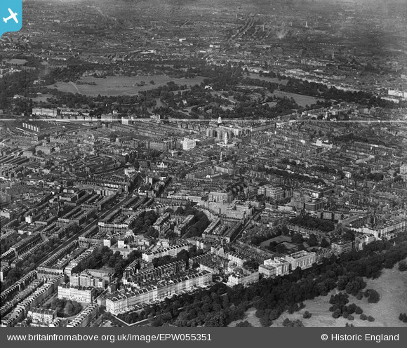
EPW055351 ENGLAND (1937). A cityscape from Hyde Park to Regent's Park, Lisson Grove, from the south, 1937
© Copyright OpenStreetMap contributors and licensed by the OpenStreetMap Foundation. 2026. Cartography is licensed as CC BY-SA.
Nearby Images (4)
EPW055351

EPW021435

EPW021409

EPW021439

Details
| Title | [EPW055351] A cityscape from Hyde Park to Regent's Park, Lisson Grove, from the south, 1937 |
| Reference | EPW055351 |
| Date | 8-September-1937 |
| Link | |
| Place name | LISSON GROVE |
| Parish | |
| District | |
| Country | ENGLAND |
| Easting / Northing | 527250, 181128 |
| Longitude / Latitude | -0.16594494732957, 51.514244352568 |
| National Grid Reference | TQ273811 |
Pins

Robin |
Friday 4th of March 2022 12:16:42 AM | |

Class31 |
Wednesday 8th of October 2014 03:36:35 PM | |
|
Class31 |
Wednesday 8th of October 2014 03:30:59 PM | |
|
Class31 |
Wednesday 8th of October 2014 03:29:45 PM | |
|
Class31 |
Wednesday 8th of October 2014 03:28:33 PM | |
|
S00Z |
Friday 6th of December 2013 05:39:28 PM | |

Alan McFaden |
Sunday 8th of September 2013 07:02:40 PM |


