
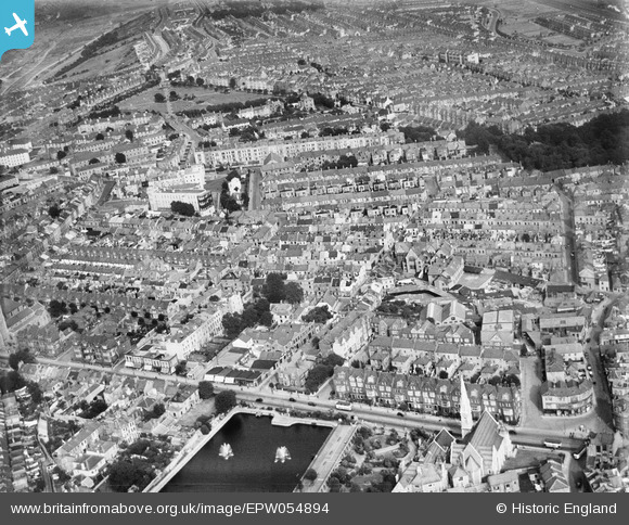
EPW054894 ENGLAND (1937). Armada Street and environs, Plymouth, 1937
© Copyright OpenStreetMap contributors and licensed by the OpenStreetMap Foundation. 2026. Cartography is licensed as CC BY-SA.
Nearby Images (5)
EPW054894

EPW054899

EPW011260

EPW054887

EPW054893

Details
| Title | [EPW054894] Armada Street and environs, Plymouth, 1937 |
| Reference | EPW054894 |
| Date | 16-August-1937 |
| Link | |
| Place name | PLYMOUTH |
| Parish | |
| District | |
| Country | ENGLAND |
| Easting / Northing | 248369, 55113 |
| Longitude / Latitude | -4.1327303565637, 50.375732406676 |
| National Grid Reference | SX484551 |
Pins

Lloyd |
Tuesday 14th of May 2019 05:21:57 PM | |
|
Janet |
Saturday 13th of June 2015 11:10:46 PM | |

Class31 |
Thursday 16th of April 2015 08:01:42 PM | |
|
Class31 |
Thursday 16th of April 2015 07:59:04 PM | |
|
Class31 |
Thursday 16th of April 2015 07:56:27 PM | |
|
Class31 |
Thursday 16th of April 2015 07:55:08 PM | |
|
Class31 |
Thursday 16th of April 2015 07:53:26 PM | |
|
Class31 |
Thursday 16th of April 2015 07:52:43 PM | |
|
Class31 |
Thursday 16th of April 2015 07:51:38 PM | |
|
Class31 |
Thursday 16th of April 2015 07:49:34 PM | |
|
Class31 |
Thursday 16th of April 2015 07:32:30 PM | |
|
peterjt |
Thursday 3rd of October 2013 04:27:16 PM |


