
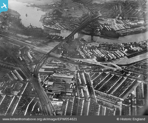
EPW054621 ENGLAND (1937). Industrial and residential areas to the south of the Queen Alexandra Bridge, Millfield, 1937
© Copyright OpenStreetMap contributors and licensed by the OpenStreetMap Foundation. 2026. Cartography is licensed as CC BY-SA.
Nearby Images (10)
EPW054621

EPW054622

EPW054623

EPW057821

EPW054626

EPW057819

EPW054624

EPW054625

EPW054628

EPW054627

Details
| Title | [EPW054621] Industrial and residential areas to the south of the Queen Alexandra Bridge, Millfield, 1937 |
| Reference | EPW054621 |
| Date | 28-July-1937 |
| Link | |
| Place name | MILLFIELD |
| Parish | |
| District | |
| Country | ENGLAND |
| Easting / Northing | 438305, 557524 |
| Longitude / Latitude | -1.402452206002, 54.910872556602 |
| National Grid Reference | NZ383575 |
Pins

Coops |
Friday 11th of March 2016 04:04:10 PM |