
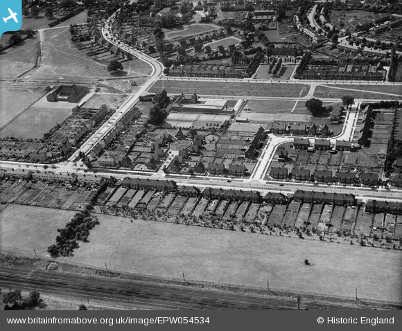
EPW054534 ENGLAND (1937). The residential area surrounding Lytton Gardens and Parkfields, Handside, 1937
© Copyright OpenStreetMap contributors and licensed by the OpenStreetMap Foundation. 2026. Cartography is licensed as CC BY-SA.
Nearby Images (12)
EPW054534

EPW054538

EPW054514

EAW013993

EPW054510

EPW062076

EAW013998

EPW062075

EPW022017

EPW054494

EPW047342

EPW054509

Details
| Title | [EPW054534] The residential area surrounding Lytton Gardens and Parkfields, Handside, 1937 |
| Reference | EPW054534 |
| Date | 30-July-1937 |
| Link | |
| Place name | HANDSIDE |
| Parish | |
| District | |
| Country | ENGLAND |
| Easting / Northing | 523663, 212580 |
| Longitude / Latitude | -0.20648983472555, 51.797728014404 |
| National Grid Reference | TL237126 |
Pins
Be the first to add a comment to this image!