
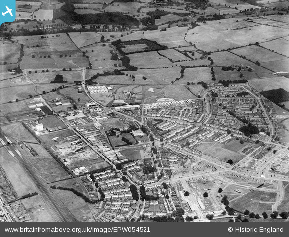
EPW054521 ENGLAND (1937). The residential and industrial area at Peartree, Welwyn Garden City, 1937
© Copyright OpenStreetMap contributors and licensed by the OpenStreetMap Foundation. 2026. Cartography is licensed as CC BY-SA.
Nearby Images (24)
EPW054521

EAW040872

EAW040874

EAW040876

EAW040871

EAW016534
, Welwyn Garden City, 1948. This image has been produced from a damaged negative.")
EPW054520

EAW040873

EAW040875

EAW016525

EAW040877

EPW054492

EAW016536
, Welwyn Garden City, 1948. This image has been produced from a damaged negative.")
EAW053106

EPW054499

EAW016523

EPW047352

EAW016530
, Welwyn Garden City, 1948. This image has been produced from a damaged negative.")
EAW016529
, Welwyn Garden City, 1948. This image has been produced from a damaged negative.")
EAW016533

EPW047354

EPW054541

EAW016531
, Welwyn Garden City, 1948. This image has been produced from a damaged negative.")
EPW054500

Details
| Title | [EPW054521] The residential and industrial area at Peartree, Welwyn Garden City, 1937 |
| Reference | EPW054521 |
| Date | 30-July-1937 |
| Link | |
| Place name | WELWYN GARDEN CITY |
| Parish | |
| District | |
| Country | ENGLAND |
| Easting / Northing | 524623, 212731 |
| Longitude / Latitude | -0.19251992177663, 51.798872004635 |
| National Grid Reference | TL246127 |
Pins
Be the first to add a comment to this image!