
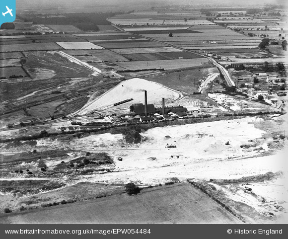
EPW054484 ENGLAND (1937). The General Refractories Brick Works and surrounding countryside, Austerfield, 1937
© Copyright OpenStreetMap contributors and licensed by the OpenStreetMap Foundation. 2025. Cartography is licensed as CC BY-SA.
Nearby Images (8)
EPW054484

EPW054483

EPW054487

EPW054486

EPW054488

EPW054482

EPW054485

EPW054489

Details
| Title | [EPW054484] The General Refractories Brick Works and surrounding countryside, Austerfield, 1937 |
| Reference | EPW054484 |
| Date | 30-July-1937 |
| Link | |
| Place name | AUSTERFIELD |
| Parish | AUSTERFIELD |
| District | |
| Country | ENGLAND |
| Easting / Northing | 465903, 394483 |
| Longitude / Latitude | -1.0077015348723, 53.442735823039 |
| National Grid Reference | SK659945 |
Pins
Be the first to add a comment to this image!